The 10 Best Road Trips in the World
Road trips have no ranking authority — no academy, no annual ceremony, nobody counting votes. So this is AVARA's own curated ten, built to a global spread (three in Europe, three in North America, one each in Oceania, South America, Africa and Asia) rather than the usual US-and-Europe default, and selected on three things: the driving itself has to be the point rather than just the transport between two places, the route has to hold up over multiple days rather than one photogenic hour, and it has to be genuinely drivable by a competent traveller without a support vehicle or an expedition permit.
What makes this a particularly good year to publish it: three of these ten have significant 2026 news. Highway 1 through Big Sur fully reopened on 14 January 2026 after three years of landslide closures, three months ahead of schedule. Norway's Trollstigen reopened on 27 April 2026 — its earliest opening ever — after rockfall closures shut it for much of 2024 and delayed it into July 2025. And Route 66 turns 100 this year, with national centennial festivities that began on 30 April 2026. If you've been waiting to drive any of those three, this is the year.
Every route below gives you start and end points, real distances, honest driving-day counts, the stops in order, when to go, and what the road actually demands of your vehicle. Google Maps links throughout.
No. 1 — Pacific Coast Highway — California, USA
San Francisco → San Diego · ~1,000 km / 620 miles · 5–7 days
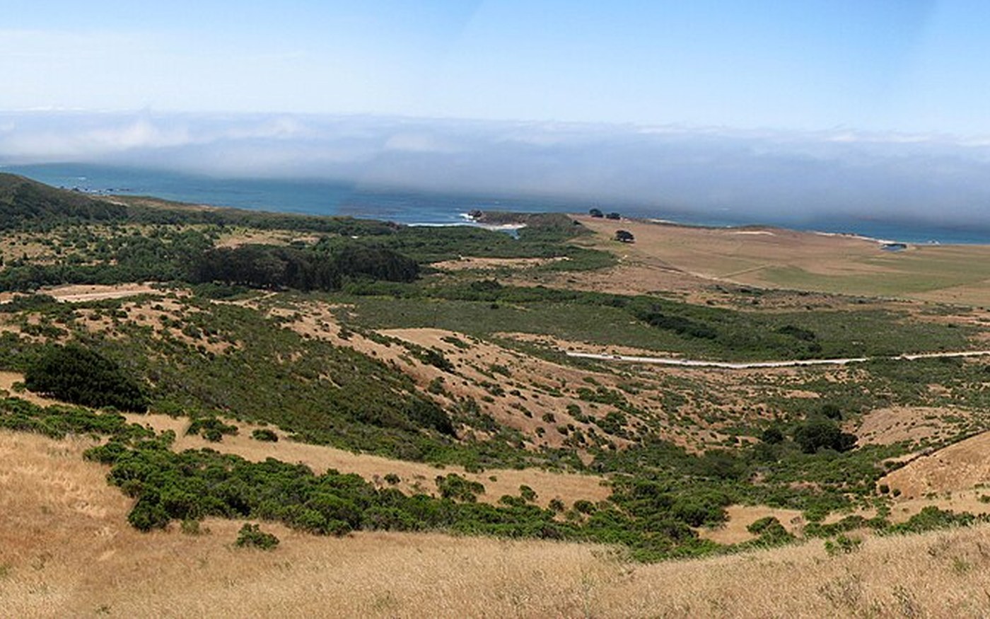
The Pacific Coast Highway tracing the Big Sur coastline. Photo: Brian Cantoni / Wikimedia Commons — CC BY 2.0. The most famous coastal drive in the world, and as of January 2026 fully drivable end to end again for the first time since 2023. The Big Sur section — cliff road, no guardrail in places, Pacific dropping away beneath you — is the reason the whole route has its reputation, and it's the part that's been shut.
The drive, stop by stop
- San Francisco — start south over the Golden Gate or straight down the peninsula. Give it a day before you leave.
- Santa Cruz — the boardwalk and the surf culture; a good, unpretentious first-night stop.
- Monterey & 17-Mile Drive — the aquarium is genuinely world-class, and the private 17-Mile Drive through Pebble Beach is worth the toll.
- Bixby Creek Bridge — the single most photographed structure on the route. Pull out early, before the tour buses.
- Big Sur — McWay Falls at Julia Pfeiffer Burns State Park, redwoods at Pfeiffer Big Sur. Stay a night here if budget allows; the road empties beautifully after dark.
- Hearst Castle, San Simeon — book the tour ahead; the elephant seal rookery just north is free and extraordinary.
- Morro Bay → Santa Barbara — the landscape softens into wine country; detour inland to the Santa Ynez Valley if you have a spare day.
- Malibu → Santa Monica → San Diego — the urban final act; La Jolla's coastline is the last genuinely great stop before the border.
When to go: September and October are the sweet spot: warmest water, clearest skies, and none of the "June Gloom" coastal fog that flattens early-summer views. Avoid deep winter when storm closures are most likely.
Road & vehicle: Ordinary rental car is fine, all paved. Note that winter storms can still trigger temporary closures at Regent's Slide and elsewhere, and construction delays persist in sections — check Caltrans before committing to a Big Sur run.
Book ahead: Big Sur accommodation (limited supply, high demand), Hearst Castle tour.
Read the big sur carmel city guide · Read the san francisco city guide · Read the los angeles city guide · Read the san diego city guide
No. 2 — Icefields Parkway — Alberta, Canada
Lake Louise → Jasper · 232 km / 144 miles · 2–3 days
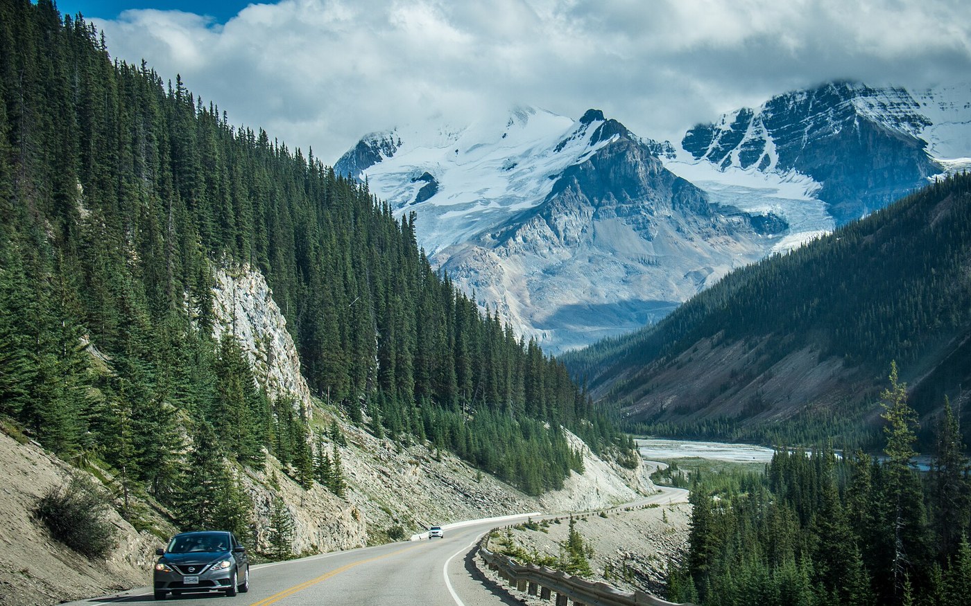
The Icefields Parkway beneath the Canadian Rockies. Photo: m01229 / Wikimedia Commons — CC BY-SA 2.0. The shortest route on this list and arguably the highest ratio of spectacle per kilometre anywhere on Earth — over 100 glaciers visible from a single road, running the spine of the Canadian Rockies between two national parks. You could drive it in three hours. Don't.
The drive, stop by stop
- Lake Louise — start here; canoe on the lake at dawn before the crowds, then hike to the Lake Agnes Tea House.
- Moraine Lake — note that private vehicles are no longer permitted; you must take the shuttle or a commercial service. Book well ahead.
- Bow Lake & Peyto Lake — Peyto's wolf-head shape from the viewing platform is the iconic Rockies photograph.
- Columbia Icefield — 132 km north of Lake Louise. The Athabasca Glacier ice explorer and the Skywalk glass platform are both genuinely worth the money.
- Sunwapta & Athabasca Falls — short walks off the highway, both powerful in early summer meltwater season.
- Jasper — Maligne Lake and Spirit Island, plus one of the world's largest dark-sky preserves for night skies.
When to go: June to September for full access and open facilities. The road stays open in winter but requires winter tyres, real caution, and acceptance that services close.
Road & vehicle: Fully paved, standard car fine in summer. Critically: there is no fuel between Lake Louise and Jasper apart from the seasonal pump at Saskatchewan River Crossing. Fill up before you start. A Parks Canada pass is required.
Book ahead: Moraine Lake shuttle, Columbia Icefield experiences, Jasper accommodation in July–August.
Read the lake louise canadian rockies city guide · Read the jasper city guide · Read the banff city guide
No. 3 — Route 66 — Chicago to Santa Monica, USA
Chicago, Illinois → Santa Monica, California · ~3,940 km / 2,448 miles · 2–3 weeks
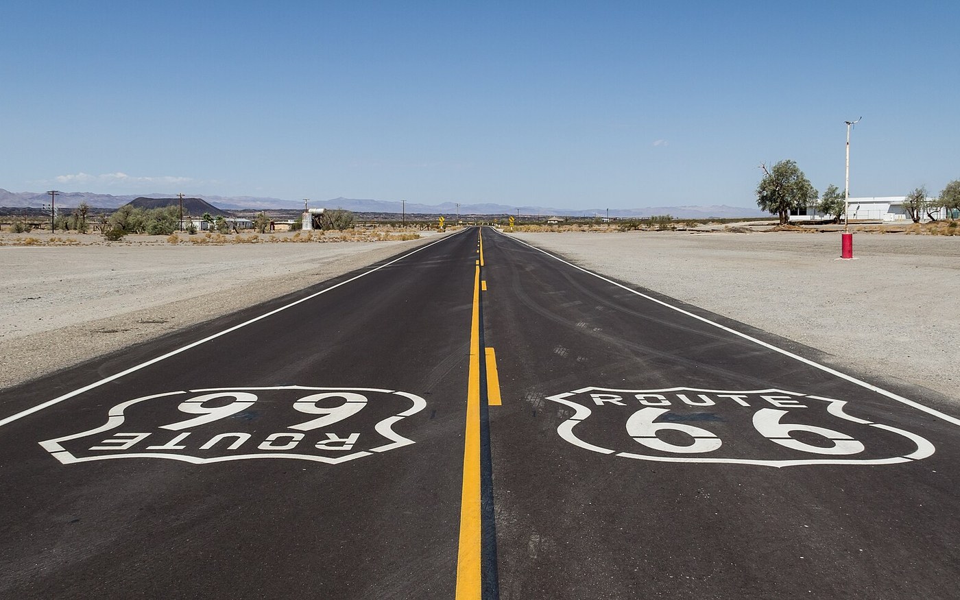
Historic Route 66 near Amboy, California. Photo: Dietmar Rabich / Wikimedia Commons — CC BY-SA 4.0. The Mother Road, crossing eight states and three time zones, and in 2026 celebrating its centennial — the highway was formally named on 11 November 1926, with national festivities having kicked off on 30 April 2026. Towns along the whole route are running centennial events all year, which makes this the single most atmospheric year to drive it in living memory.
The drive, stop by stop
- Chicago, Illinois — the official "Begin" sign on Adams Street. Breakfast at Lou Mitchell's, a Route 66 institution since 1923.
- Springfield, Illinois → St. Louis, Missouri — Lincoln history, then the Gateway Arch.
- Galena, Kansas — Kansas has only 13 miles of Route 66, so enjoy it fast.
- Tulsa & Oklahoma City, Oklahoma — the deepest concentration of preserved Art Deco and neon on the route; Sapulpa hosts its Route 66 Blowout on 12 September 2026.
- Amarillo, Texas — Cadillac Ranch, ten cars buried nose-down in a field, spray paint encouraged.
- Tucumcari & Santa Fe, New Mexico — Tucumcari's neon motel strip after dark is the best-preserved stretch of mid-century Americana anywhere on the road.
- Petrified Forest, Winslow & Flagstaff, Arizona — the only national park containing a segment of Route 66; Flagstaff's own centennial celebration lands on 6 June 2026. Detour to the Grand Canyon.
- Seligman & Oatman, Arizona — the most characterful surviving small towns, wild burros wandering Oatman's main street.
- Santa Monica Pier, California — the "End of the Trail" sign, and the Pacific.
When to go: May–June or September–October. Summer through Texas, Oklahoma and Arizona is punishing. Time it to a centennial event if you can.
Road & vehicle: Any car. The real challenge is navigation — original alignments frequently diverge from the interstate, and following the historic route properly requires a dedicated Route 66 guide or app rather than default satnav directions.
Book ahead: Centennial-year demand is unusually high; book the landmark motels (Blue Swallow in Tucumcari, Wigwam Motels) months out.
Read the chicago city guide · Read the st louis city guide · Read the santa fe city guide · Read the petrified forest national park city guide · Read the los angeles city guide
No. 4 — Ring Road (Route 1) — Iceland
Reykjavík → Reykjavík (full circle) · 1,328 km / 825 miles · 7–10 days
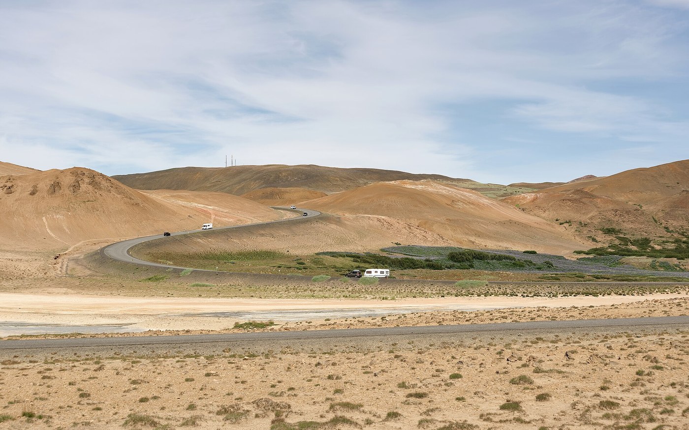
Route 1 near Hverarönd in northern Iceland. Photo: Jakub Hałun / Wikimedia Commons — CC BY 4.0. Europe's longest ring road, and the most efficiently spectacular loop in the world: waterfalls, black-sand beaches, glacier lagoons, geothermal fields and fjords, all strung along one circular highway with almost no backtracking.
The drive, stop by stop
- Reykjavík — start and finish; a day either end.
- Golden Circle detour — Þingvellir, Geysir, Gullfoss. Technically off the Ring Road, universally worth it.
- Seljalandsfoss & Skógafoss — the first of the great south-coast waterfalls; you can walk behind Seljalandsfoss.
- Vík & Reynisfjara — the black-sand beach. Take the sneaker-wave warnings seriously; people die here regularly.
- Jökulsárlón glacier lagoon & Diamond Beach — icebergs calving into a lagoon and washing up on black sand. The single best stop on the loop.
- Höfn → Egilsstaðir → the Eastfjords — the quietest quarter of the island; detour to Seyðisfjörður for the rainbow street and the Blue Church.
- Mývatn & Dettifoss — geothermal lake district, plus Europe's most powerful waterfall by volume.
- Akureyri & Húsavík — Iceland's northern capital, and the best whale watching in the country.
- Snæfellsnes Peninsula — Kirkjufell mountain, and a good final flourish before Reykjavík.
When to go: June–August for the midnight sun, full access to highland side-routes and the most reliable road conditions. September–October for autumn colour, thinner crowds and the season's first northern lights. Winter driving is genuinely demanding — four hours of daylight in December and frequent weather closures.
Road & vehicle: The Ring Road itself is fully paved and 2WD-friendly in summer. A 4x4 is only necessary for F-roads into the highlands, which are summer-only and prohibited to 2WD vehicles. Check road.is daily — conditions change fast in any season.
Book ahead: Everything, in summer. Iceland's accommodation supply is small relative to demand, and last-minute options are punishingly expensive.
Read the reykjavik city guide · Read the akureyri city guide
No. 5 — North Coast 500 — Scotland
Inverness → Inverness (full loop) · 830 km / 516 miles · 5–7 days
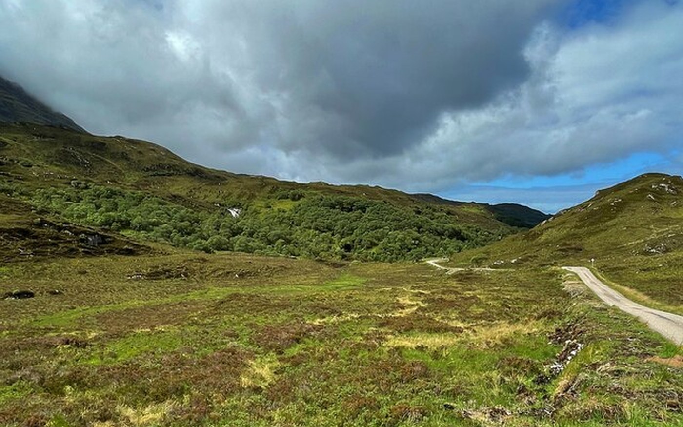
A single-track section of Scotland's North Coast 500. Photo: Graham Hogg / Wikimedia Commons — CC BY-SA 2.0. Launched in 2015 and now firmly established as Scotland's great drive: a loop from Inverness Castle around the entire northern Highlands, through Wester Ross, Sutherland and Caithness, taking in single-track coastal roads, empty beaches, castles and an improbable number of distilleries.
The drive, stop by stop
- Inverness — start at the castle. Loch Ness is 20 minutes south if you want it.
- Applecross via Bealach na Bà — the most demanding road in Britain: hairpins, 20% gradients, single track. Not for caravans or nervous drivers. The Applecross Inn at the end is the reward.
- Torridon & Gairloch — the most dramatic mountain scenery on the route.
- Ullapool — the best base town on the west coast; seafood and ferry connections to the Outer Hebrides.
- Achmelvich & Clachtoll beaches — white sand and turquoise water that looks photoshopped and isn't.
- Durness & Smoo Cave — the north-west corner; Balnakeil Beach is extraordinary and usually empty.
- Thurso & John o' Groats — the north coast proper; detour to Dunnet Head, the actual northernmost point of mainland Britain.
- Dunrobin Castle & the east coast — a fairytale castle and a faster run back down to Inverness, with distilleries (Glenmorangie, Clynelish) en route.
When to go: May–June and September. July–August brings both peak traffic and peak midges; winter brings very short daylight. May is arguably ideal — long days, fewer midges, everything open.
Road & vehicle: Any car, but much of the west coast is single-track with passing places — learn the etiquette (pull in, let faster traffic through, wave) before you go. Fuel stations are sparse in the north-west; don't run below a quarter tank.
Book ahead: Accommodation, absolutely — the route's popularity has outpaced its bed supply, and wild-camping tensions with locals are real. Book, don't improvise.
Read the scottish highlands isle of skye city guide · Read the isle of skye city guide
No. 6 — Trollstigen & the Atlantic Road — Norway
Bergen → Ålesund (via Geiranger & Trollstigen) · ~600 km / 373 miles · 5–7 days
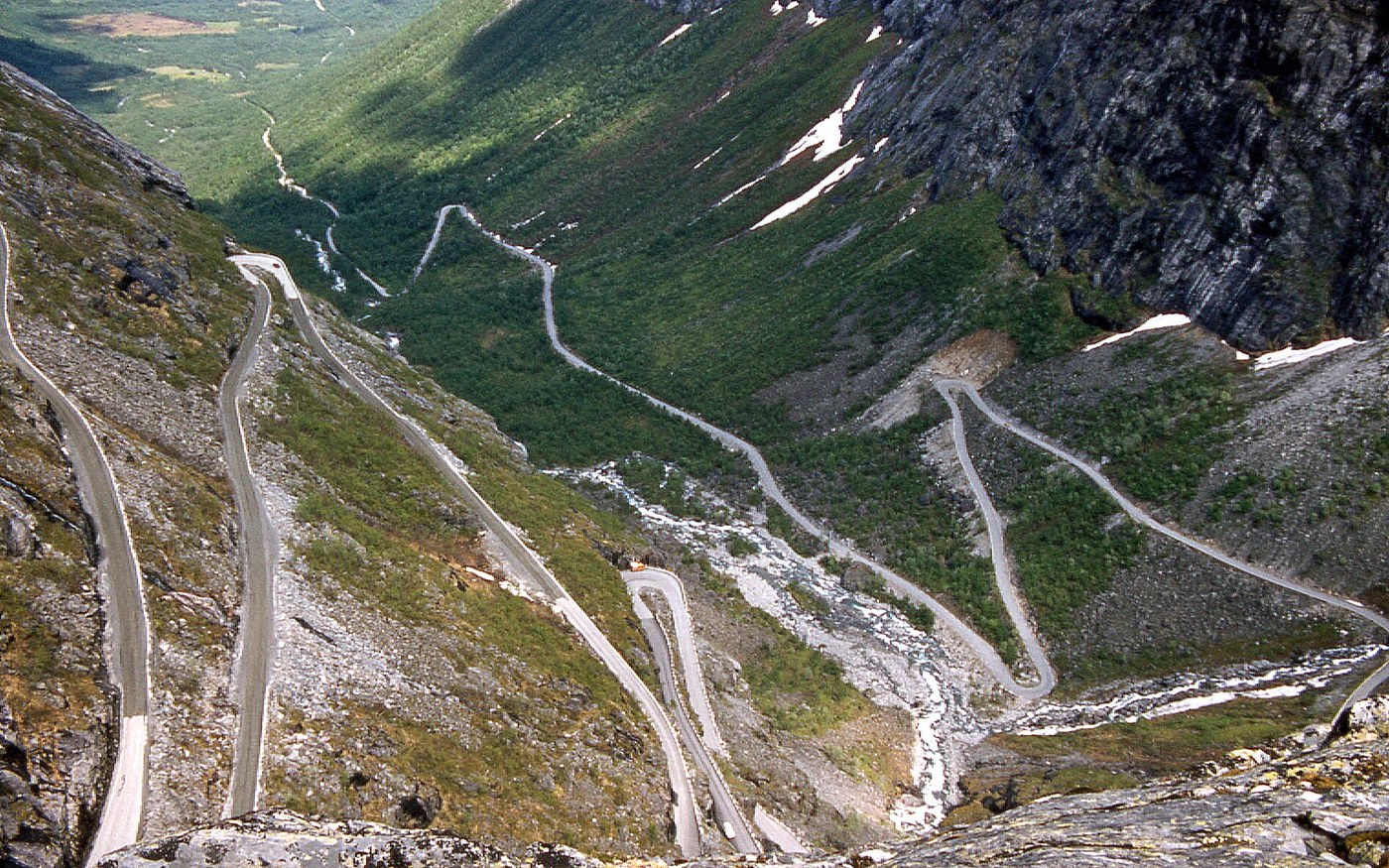
Trollstigen's eleven hairpins climbing the valley wall. Photo: W. Bulach / Wikimedia Commons — CC BY-SA 4.0. Norway's fjord country condensed into one route, combining two of the most celebrated engineered roads in Europe: Trollstigen's eleven hairpin bends climbing a near-vertical valley wall, and the Atlantic Road's low bridges hopping between skerries with waves breaking over the tarmac in a storm.
The drive, stop by stop
- Bergen — Bryggen wharf, the funicular up Fløyen, and the fish market. Start with a full day here.
- Nærøyfjord & Flåm — a UNESCO-listed fjord arm; the Flåm Railway is one of the world's great short train rides.
- Geirangerfjord — the Seven Sisters waterfall, and the Ørnesvingen eagle-bend viewpoint on the way out.
- Trollstigen — eleven hairpins, a 9% gradient and a cantilevered viewing platform at the top. Drive it uphill for the better experience.
- Åndalsnes — take the Romsdalen gondola for the valley panorama.
- The Atlantic Road (Atlanterhavsveien) — 8 km of bridges island-hopping across open ocean; the Storseisundet Bridge is the famous one. Go in rough weather if you can — that's when it's spectacular.
- Ålesund — an entire town rebuilt in Art Nouveau after a 1904 fire; climb Aksla for the view over it.
When to go: Late May to September. Trollstigen is seasonal — it reopened on 27 April 2026, its earliest opening on record, and typically runs until October or November depending on snow. It was closed for much of 2024 and into July 2025 after rockfalls, so check status before building a trip around it.
Road & vehicle: Paved throughout, standard car fine. Several fjord crossings require car ferries — frequent, efficient, and generally no booking needed. Norway is expensive: budget accordingly for fuel, tolls and ferries.
Book ahead: Accommodation in Geiranger and Flåm in July–August; ferries generally not necessary.
No. 7 — Great Ocean Road — Victoria, Australia
Torquay → Allansford · 240 km / 150 miles · 2–4 days
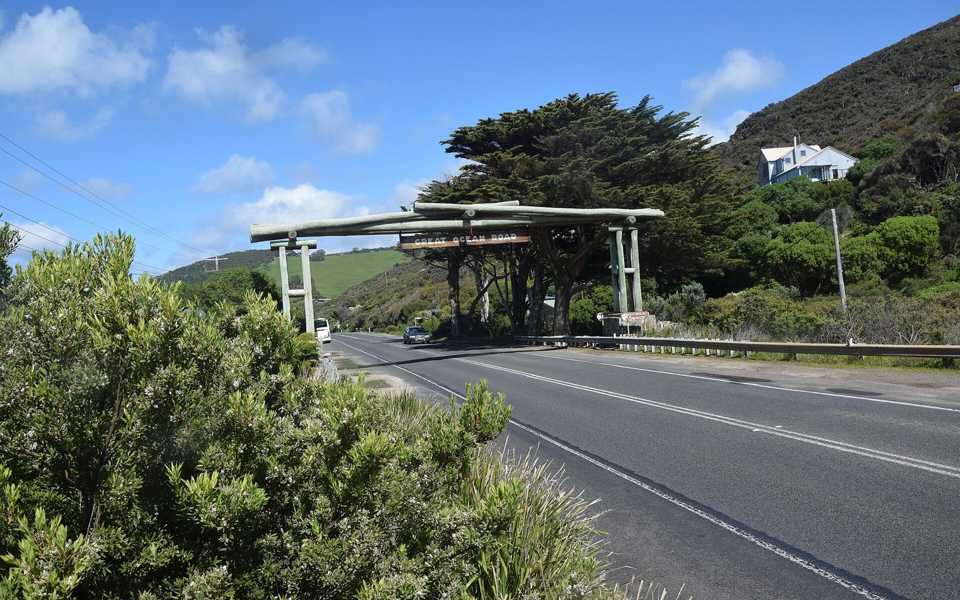
The Great Ocean Road along Victoria's southern coast. Photo: Ank Kumar / Wikimedia Commons — CC BY-SA 4.0. Built by returning First World War soldiers and dedicated to those killed in the conflict — making it the largest war memorial on Earth. It's short enough to rush in a day, which is exactly what most visitors do and exactly why they miss it.
The drive, stop by stop
- Torquay — the official start and Australia's surf capital; Bells Beach is here.
- Memorial Arch, Eastern View — the ceremonial gateway and the obligatory photograph.
- Lorne — the most attractive town on the route; Erskine Falls is a short drive inland.
- Kennett River — the most reliable place on the whole route to see wild koalas in the eucalypts.
- Apollo Bay → Cape Otway — rainforest, the mainland's oldest surviving lighthouse, and the Otway Fly treetop walk.
- The Twelve Apostles — limestone stacks in the Southern Ocean. Go at sunrise: you'll have them nearly alone, and the light is better.
- Loch Ard Gorge & London Bridge — arguably more atmospheric than the Apostles themselves, and far less crowded.
- Port Campbell → Allansford — the quiet finish; continue to Warrnambool for southern right whales between June and September.
When to go: Australian spring and autumn — September to November, or March to May. Summer (December–February) is peak domestic holiday season and the road gets genuinely congested. Winter brings dramatic seas and whale sightings off Warrnambool.
Road & vehicle: Any car, fully paved, but genuinely winding — allow far more time than the distance suggests. Drive on the left. Watch for wildlife at dawn and dusk.
Book ahead: Accommodation in Lorne and Apollo Bay over summer and public holidays.
Read the great ocean road city guide · Read the melbourne city guide
No. 8 — Carretera Austral (Ruta 7) — Chile
Puerto Montt → Villa O'Higgins · 1,240 km / 770 miles · 2–3 weeks
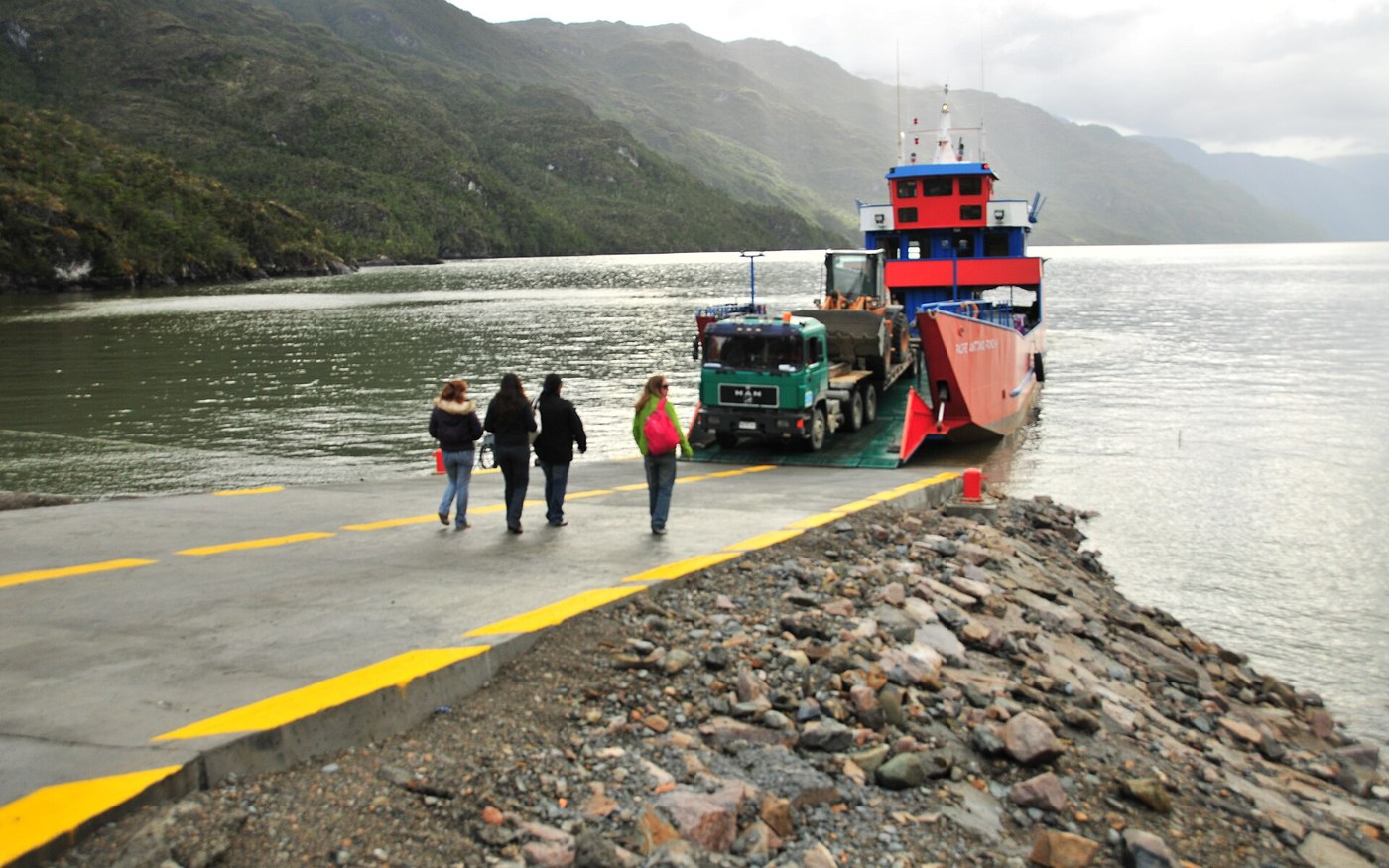
Ruta 7 through the remote landscape of Chilean Patagonia. Photo: Chile365 / Wikimedia Commons — CC BY-SA 3.0. The wildest drive on this list: Pinochet-era road-building through Chilean Patagonia, connecting fjords, temperate rainforest, hanging glaciers and turquoise rivers, with the road itself interrupted three times by fjords that have to be crossed by ferry. Most of the northern section is now paved; the southern half remains gravel.
The drive, stop by stop
- Puerto Montt / Puerto Varas — start in Puerto Varas rather than Puerto Montt; it's far nicer, on a lake beneath two volcanoes.
- Hornopirén ferry — the first mandatory crossing (Hornopirén–Leptepu, then Fiordo Largo–Caleta Gonzalo on one ticket). This is the one you must book in advance.
- Parque Pumalín — temperate rainforest and alerce trees, part of the Tompkins conservation legacy.
- Chaitén → Futaleufú — detour east to Futaleufú for some of the best whitewater rafting on the planet.
- Queulat National Park — the Ventisquero Colgante hanging glacier, spilling meltwater off a cliff into a lagoon.
- Puyuhuapi → Coyhaique — the region's only real city; restock, refuel, resupply here.
- Puerto Río Tranquilo — boat out to the Marble Caves on General Carrera Lake, one of South America's most photographed natural formations.
- Caleta Tortel — a village with no streets, built entirely on cypress boardwalks above the water.
- Villa O'Higgins — the end of the road, literally. The only way further south is a boat-and-hike crossing into Argentina.
When to go: December to March — the Southern Hemisphere summer. Outside that window, ferries reduce frequency, many lodges close and weather turns genuinely hostile.
Road & vehicle: High-clearance vehicle strongly recommended; the southern gravel gets greasy in rain and is hard on tyres. Three mandatory ferries — two you simply turn up for, one requires advance booking. Fuel discipline is essential: fill whenever you see a station, as gaps run over 200 km. Check rental terms — many Chilean companies charge extra for one-way drops and require permission for gravel routes.
Book ahead: The Hornopirén ferry (months ahead in January–February), and the vehicle itself.
No. 9 — Garden Route — South Africa
Cape Town → Gqeberha (Port Elizabeth) · ~800 km / 500 miles · 7–10 days
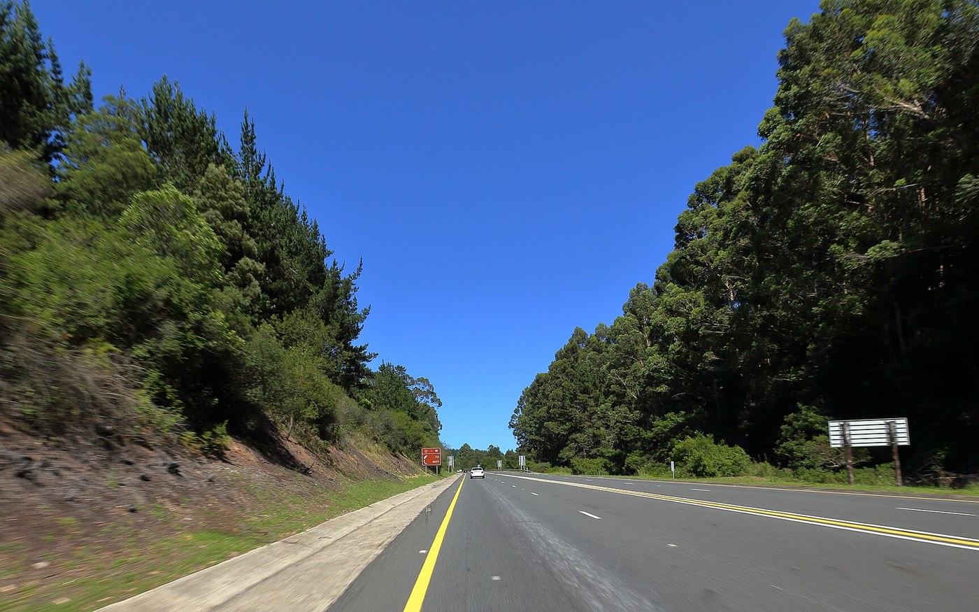
On the Garden Route through South Africa's southern coast. Photo: Diriye Amey / Wikimedia Commons — CC BY 2.0. The official Garden Route runs just 180 km between Mossel Bay and Storms River, but the drive worth doing starts in Cape Town and runs the whole southern coast: wine country, whale coast, indigenous forest, lagoons and a mountain pass or two, ending in safari country.
The drive, stop by stop
- Cape Town — Table Mountain, the Cape Peninsula drive to Cape Point, and Boulders Beach penguins. Give it three days minimum.
- Stellenbosch & Franschhoek — the Cape Winelands; the Franschhoek wine tram is a genuinely good way to do it without driving.
- Hermanus — southern right whales calve in the bay from roughly June to November, visible from the cliff path.
- Mossel Bay → George — the official start of the Garden Route proper.
- Wilderness & Knysna — lagoons, the Knysna Heads, and oysters. The best mid-route base.
- Plettenberg Bay — beaches, Robberg Nature Reserve's peninsula hike, and Birds of Eden.
- Tsitsikamma & Storms River — the suspension bridge over Storms River Mouth, and the world's highest commercial bungee at Bloukrans if that appeals.
- Addo Elephant National Park — finish with a malaria-free Big Five park and over 600 elephants, an hour from Gqeberha.
When to go: Spring (September–November) or autumn (February–April) for good weather and thinner crowds. If whale watching matters, Hermanus between June and November — peaking in September and October — is among the best land-based whale watching in the world.
Road & vehicle: Excellent paved roads throughout, standard car entirely adequate. Drive on the left. Avoid driving at night between towns, and use standard urban security precautions in cities.
Book ahead: Addo accommodation and game drives; Franschhoek wine tram in high season.
Read the garden route city guide · Read the cape town city guide · Read the addo elephant national park city guide
No. 10 — Leh–Manali Highway — Ladakh, India
Manali → Leh · ~430 km / 267 miles · 2 days minimum (plus acclimatisation)
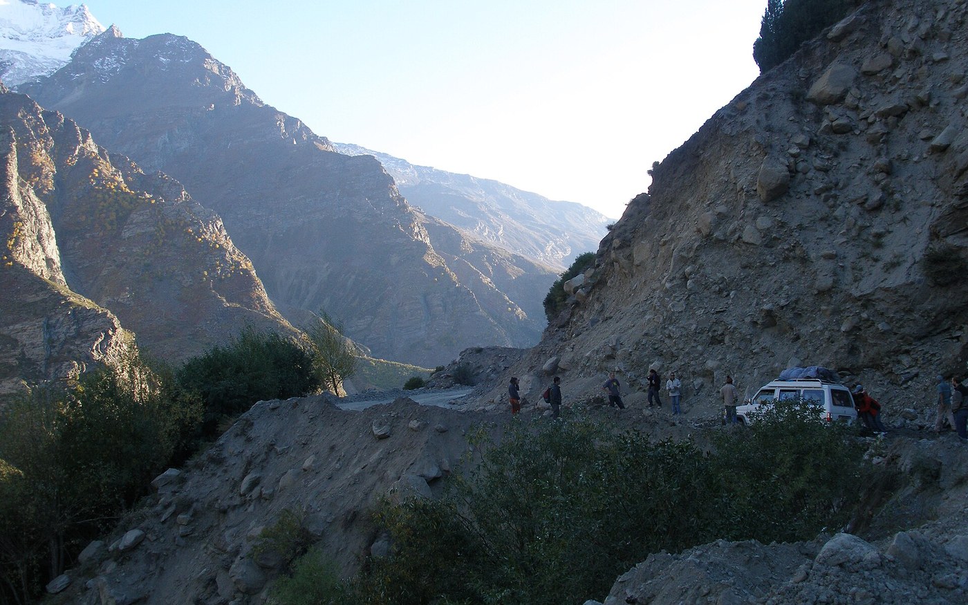
The Leh–Manali road through the high Himalaya. Photo: Vyacheslav Argenberg / Wikimedia Commons — CC BY 4.0. The highest-altitude drive on this list and the most physically demanding: a Himalayan crossing over four major passes, topping out above 5,000 m, through a landscape with essentially no vegetation and no meaningful infrastructure. It is not the longest route here, and it is comfortably the hardest.
The drive, stop by stop
- Manali — the southern trailhead. Spend a night; you'll be gaining serious altitude fast.
- Atal Tunnel / Rohtang La — the tunnel now bypasses the notorious Rohtang Pass, making the first leg dramatically faster and safer than it once was.
- Keylong / Jispa — the standard first-night halt, at around 3,200 m. Sleeping here rather than pushing on is the single best thing you can do for acclimatisation.
- Baralacha La (4,890 m) — the first of the great passes, often with snow walls either side of the road well into summer.
- Sarchu → Gata Loops — twenty-one hairpin bends climbing the plateau; Sarchu's tented camps sit at 4,250 m and are genuinely hard to sleep at.
- Lachulung La & the More Plains — forty kilometres of dead-flat high-altitude desert, one of the strangest landscapes on any road anywhere.
- Tanglang La (5,328 m) — the highest point of the route and among the highest motorable passes on Earth.
- Leh — monasteries at Thiksey and Hemis, and the Nubra Valley or Pangong Tso as onward extensions if you have the days.
When to go: Late May to mid-November, entirely dictated by snow clearance on the passes by the Border Roads Organisation. BRO cleared the highway end-to-end on 12 May 2026, with civilian traffic permitted in the following days after a joint safety assessment. June through September is the reliable window; September is the connoisseur's month for clear skies and settled weather.
Road & vehicle: 4x4 or a high-clearance SUV, with a driver who knows the road if you're not confident — river crossings, landslide zones and unpaved stretches are routine. Altitude is the real danger, not the driving: acute mountain sickness is common and occasionally fatal here. Acclimatise properly, ascend gradually, carry medication, and be prepared to turn back. Fuel up at Tandi — the sign there reads that it's the last pump for 365 km, and it means it. Permits are required for some onward areas beyond Leh.
Book ahead: Vehicle and driver; inner-line permits for Nubra/Pangong extensions.
Read the leh ladakh city guide · Read the shimla manali city guide
Volume 8 of the AVARA Best Of series, alongside the World's 20 Best Hotels, World's 25 Best Restaurants, 20 Best Cocktail Bars in Asia, 10 Best Weekend Getaways in Europe, 25 Best Ski Resorts, 10 Italian Coastal Towns, and 7 Best Safaris. Same disclosure as the other curated volumes: no ranking authority exists for road trips, so this reflects AVARA's own criteria — the driving has to be the point, the route has to sustain multiple days, and it has to be genuinely achievable by an ordinary competent traveller.
Road status and seasonal data verified September 2026. Conditions on several of these routes — Big Sur, Trollstigen, the Leh–Manali passes and the Carretera Austral ferries — change with weather and season. Always check the relevant national road authority before departure.
Sources checked September 2026: Caltrans and the California Governor’s Office, Parks Canada, National Park Service, Route 66 Centennial Commission, Norwegian road and tourism authorities, India’s Border Roads Organisation, and relevant national road authorities.
See the full AVARA Best Of collection · Browse all AVARA city guides